


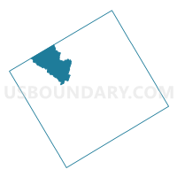
Voting District 0111, Coryell County, Texas
About
Outline

Summary
| Unique Area Identifier | 671784 |
| Name | Voting District 0111 |
| County | Coryell County |
| State | Texas |
| Area (square miles) | 58.40 |
| Land Area (square miles) | 58.37 |
| Water Area (square miles) | 0.03 |
| % of Land Area | 99.95 |
| % of Water Area | 0.05 |
| Latitude of the Internal Point | 31.49697800 |
| Longtitude of the Internal Point | -97.97314320 |
Maps


Graphs
Select a template below for downloading or customizing gragh for Voting District 0111, Coryell County, Texas


Neighbors
Neighoring Voting District (by Name) Neighboring Voting District on the Map
- Voting District 0012, Hamilton County, TX
- Voting District 0023, Hamilton County, TX
- Voting District 0108, Coryell County, TX
- Voting District 0109, Coryell County, TX
- Voting District 0110, Coryell County, TX
- Voting District 0116, Coryell County, TX
Top 10 Neighboring County Subdivision (by Population) Neighboring County Subdivision on the Map
- Hamilton CCD, Hamilton County, TX (5,871)
- Purmela-Levita CCD, Coryell County, TX (1,668)
- Evant CCD, Coryell County, TX (1,289)
Top 10 Neighboring Unified School District (by Population) Neighboring Unified School District on the Map
- Gatesville Independent School District, TX (23,029)
- Evant Independent School District, TX (1,416)
- Jonesboro Independent School District, TX (1,095)